Aids to Marine Navigation II – Beyond Lateral Marks
April 7th, 2025 by team

by B.J. Porter (Contributing Editor)
Last year, we started talking about aids to navigation and discussed lateral marks and the coloring, shape, and sounds used to identify them. Lateral marks are the most common marks you will find in your local waters, but there are many other aids and marks you may come across to help you navigate safely.
You may not see them regularly in your home waters unless you travel near shipping lanes. Larger ships use some of these larger and special marks, so they may only be near the biggest channels. But they’re not always in shipping lanes, and you can use them for your own safe navigation any time you see them.
Lighthouses
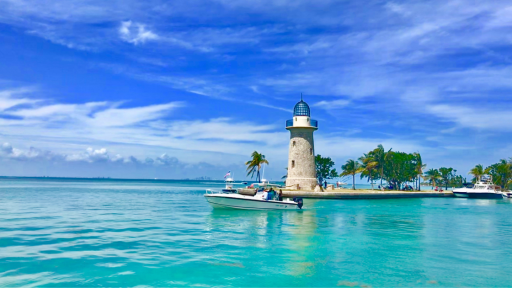
Lighthouses of old seemed some of the loneliest buildings in the world, with loads of history and romance about the solitary lighthouse keeper and his family staving off the dangers of the coast at night and in bad weather.
Modernization has fully automated or replaced most lighthouses. New lighthouses are a rarity, and many originas are augmented by additional signals. But we still need their function, and the original lighthouses were strategically positioned to address particular hazards. So many old light stations are still operational, though the lighthouse keeper is largely a thing of the past.
Automated light posts may fully replace some lighthouses and replicate some lighthouse functions. Many existing lighthouses remain inactive, and we maintain them for their historical significance, often incorporating small museums or visitor access.
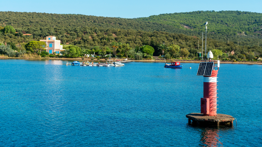
Beacon Lights
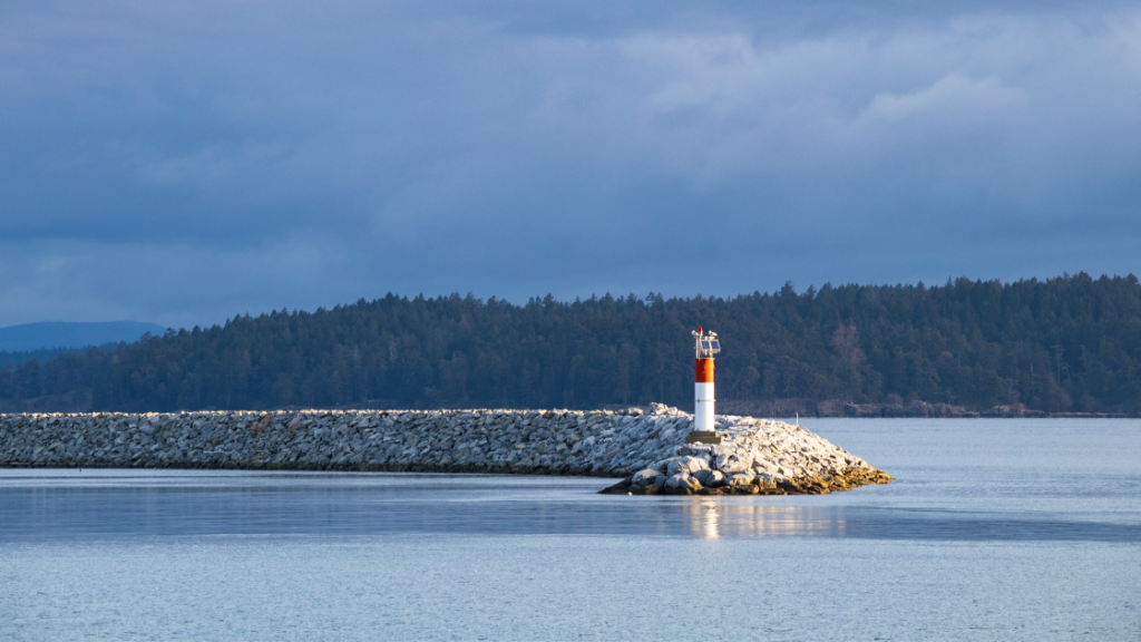
Most lighthouses are simple beacons. They rotate or flash at a fixed interval and are tall and visible for miles. Often, the lights are white, but they may be other colors. Charts clearly mark them, describing the light period and providing descriptive notes about the lighthouse, such as its height above water. The charts may also show the expected visibility range, though this may vary with weather.
Many of these lights may have a horn or other sound associated with them for low visibility conditions. Beacon lights will warn of a highly dangerous area, so mariners can get a good fix on their location and stay clear.
Sector Lights
A lighthouse can display different light patterns in different directions to warn approaching vessels of dangers. Sector lights show colors in exact directions, noted in bearing in true degrees as seen from the sea.
One common use is for white lights to show the safe path, and red and/or green lights to show danger zones. A white light is in the center of the safe approach, with a red and green sector on either side. If the color of your view of the lighthouse changes from white, you’re no longer on a safe course and need to correct course according to the light.
A good example of a sector light is the New London Harbor Light in the example below.
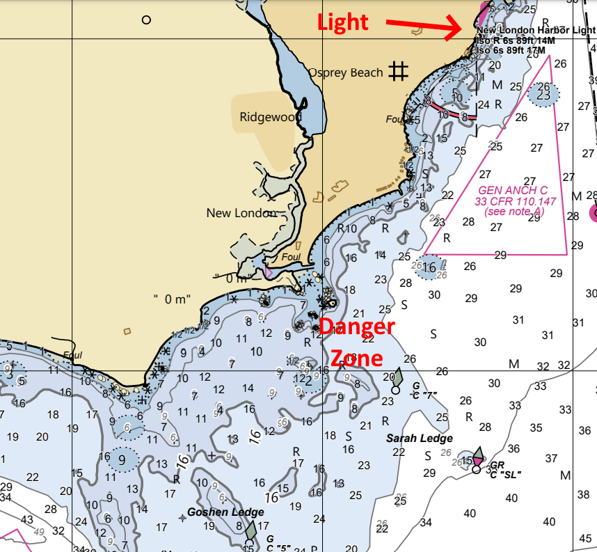
Anywhere that the red sector of the light is visible is a dangerous approach, such as over Goshen Ledge or any of the shallows, shoals and rocks in the red sector. But approaching the harbor from any other direction is safe.
Look carefully at all sector lights, and make sure if you’re approaching, you are coming in the right way, especially in the dark.
Safe Water Marks
Safe water marks have vertical red and white color schemes to show wide-open, safe waters for shipping traffic. These markings often appear at bay entrances, in shipping zones, and in mid-channel areas. All around the safe water mark is clear of all obstructions and hazards.
They may carry a light, have a red ball on top, and included a sound for reduced visibility conditions. Small boats may use them as navigation fixes, but most safe water marks are “Safe” for large ships and the surrounding waters are deep. A private vessel will have no danger anywhere nearby.
Isolated Danger Marks
These mark a specific danger directly at the mark. One may safely pass the marks on all sides, but exercise caution when navigating around them.
These are marked with horizontal red and black bands and may have a light or letters.
Special Aids
Yellow marks may show a variety of information about an area, including designating anchorages, traffic separation zones, cables, military restrictions, jetties or other special areas. They may have a letter and should appear on charts.
These are used to convey special information, and you may need to reference the chart to learn what the designation is. Use caution when entering or anchoring until you understand what the aids are telling you.
Radar beacons
A radar beacon, or racon, is an active visibility measure installed on prominent aids to navigation. The coast guard or other entities can add them to lighthouses, buoys, bridges, or other objects requiring radar detection, like oil rigs.
A racon listens for a normal radar scan. When it receives one, instead of reflecting the pulse back like a passive object, it sends specific radar pules on the detected frequency. This usually looks like a series of dashed lines coming out of the object with the racon attached.
Spotting aan object with a radar beacon is unmistakable and very hard to miss, which, of course, is the intent.
Range markers
When approaching a narrow channel or harbor, range marks on land or in the water may help find the proper channel for approaching vessels.
There are two parts to a ranger mark set – a taller rear marker, and a shorter one some distance in front of it. Both markers display the same pattern of vertical stripes; two matching colors are on the outside, and a different color is in the middle. Lights may also be present, or lettering may be added. If lit, the taller light will be on the rear mark, and the rear mark is usually fixed while the front mark flashes according to a pattern.
To use them, continue navigating parallel to the harbor approach and shore until the range marks line up. When they line up, a course sailed directly at them will take you into the channel. Some longer passages may use several sets of range marks to guide ships safely through.
When lining up range marks, travel in the direction which brings them closer together. If they are moving part, then you will never line up the harbor.
Other common marks and more information
The U.S. Coast Guard “U.S. Aids to Navigation System” pamphlet is available free, online here. Though it applies only to U.S. waters, all boaters who navigate in the U.S. should read through it and be familiar with the contents.
In it you’ll find additional information about:
- Non-lateral aids to navigation, which are diamond shaped dayboards to help with navigation.
- Information and regulatory marks, usually put in place by local authorities to mark dangers, hazards, exclusions zones, or give information.
- State waters obstruction mark, which marks a hazard between the mark and the shoreline.
- Mooring buoys, private and public.
It also provides good information about using marks at night, navigating after dark, and other important safety tips. Give it a read!

April 14, 2025 at 9:11 pm, Eric Gritzmacher said:
I am with the USCG Auxiliary and teach navigation rules. I was not aware of the sector lights having different colors depending upon the approach. thanks for educating me.