Why AIS Is An Important Tool For All Boaters
November 6th, 2024 by team

by B.J. Porter (Contributing Editor)
Over the past years, we’ve about a lot of boat electronics, like what’s an MMSI and what do you need DSC for. We’ve touched upon the Automatic Information System (AIS) briefly, but never discussed it extensively. Now it’s time for that deep dive. Because AIS an important tool for any boater to understand. Even if you decide it’s unnecessary for your boat.
What is AIS?

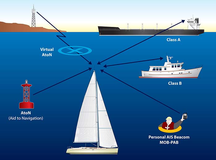
The Automatic Information System is a data transmission tool which allows all vessels with a receiver to get detailed information about ships sending AIS signals. Those with AIS transceivers (also known as transponders) will send information about their own ship for others to see.
An AIS signal broadcasts a vessel’s name, MMSI, course, position, and speed. It also may send more details like the length, beam, destination, and vessel type, depending on class of AIS transceiver and how it’s programmed.
The primary uses of AIS for recreational boaters are for collision avoidance and enhanced safety at sea, but there are many other ways this powerful tool is used to improve navigation, search and rescue, and traffic monitoring.
Classes of AIS
Class A AIS is more expensive, functional, and complex, and is for large commercial ships. It’s more powerful and has a higher signal priority.
Class B AIS for recreational boating doesn’t require a dedicate display, and is lower powered. Though it requires a GPS antenna, it’s still a reasonable option for recreational use. A newer Class B+ standard for smaller commercial vessels is now available, but its extra power and priority signals are not important for non-commercial use.
How does it work?

The critical thing to know about AIS is that it is based on VHF radio technology. AIS transmits a small amount of digital information over a dedicated VHF channel, usually every thirty seconds for Class B transceivers.
Because it’s VHF based, it has the same limitations as VHF voice radio, such as line-of-sight horizon communication limits. Since the signal is small and digital, with a good installation, you can pick up Class A and some Class B vessels many miles before you see them.
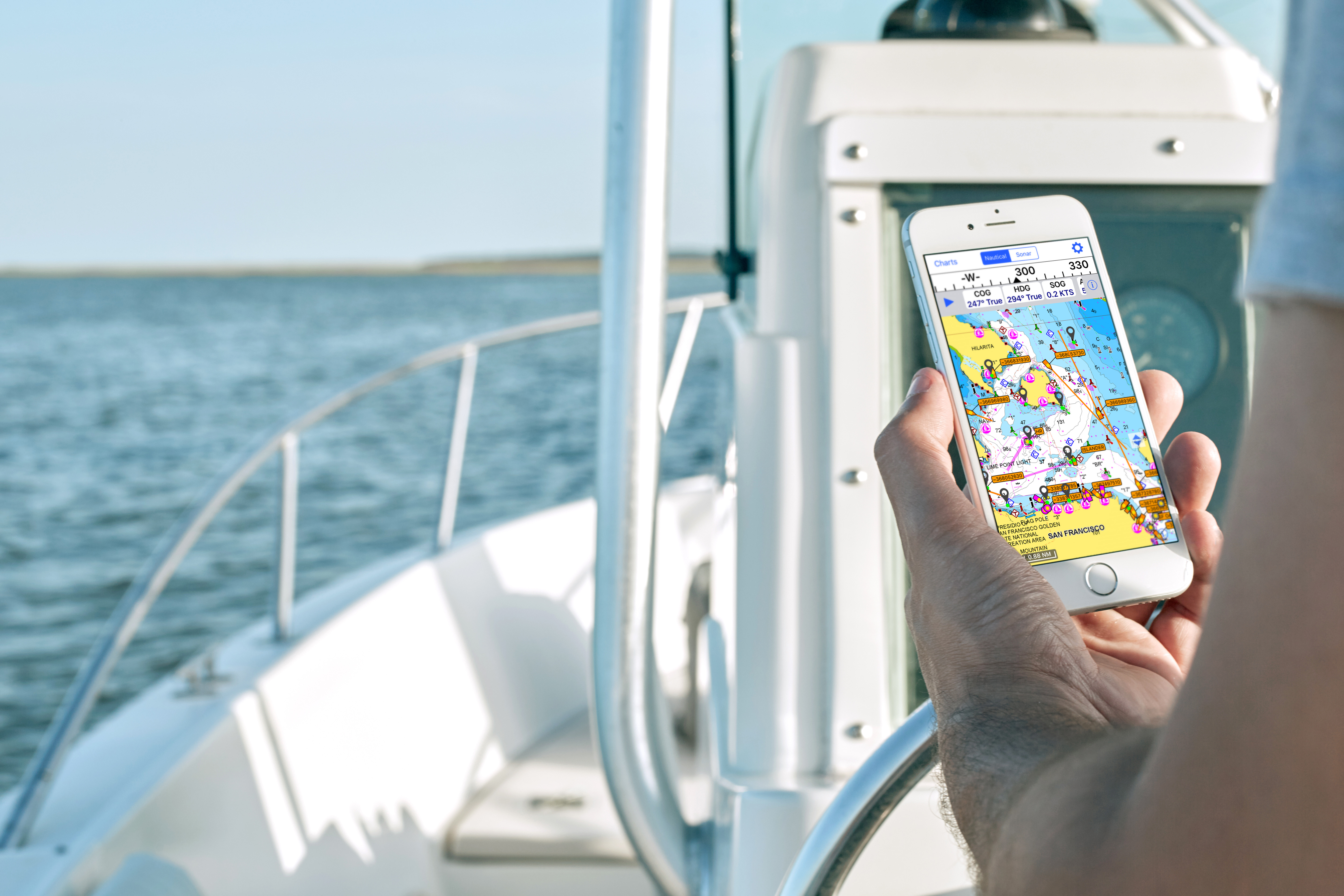
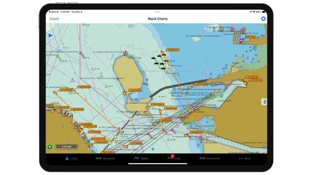
Once you turn on your transceiver, it will automatically broadcast the information it picks up from your electronics to anyone in range and start listening for other boats. Newer electronics installations show AIS data overlaid on a dedicated chart plotter, though dedicated AIS screens are an option if you don’t have a plotter, as are Apps like iNavX.
The advantages of using AIS
When I’m on the water, I like to be visible. And I also like to know as much as I can about every boat around me. Having a course, range, speed and vessel name makes an enormous difference in my ability to avoid close calls.
AIS targets on a chart plotter give you accurate information about how close other boats will come to you, how long it will take to get near them, and if there’s a risk of collision. Alarms can trigger, and you’ll have early warning of collision risks and instant analysis of how your course changes affect closing distances.
With AIS, your instruments can usually display:
- Range and bearing to target
- Closest Point of Approach (CPA)
- Time to CPA
- Target speed, heading, and rate of turn.
A chart plotter can also show visual clues, like velocity vectors and color coding for threats or friends.
Say hello to my little boat
Your AIS transceiver sends out a big “here I am” signal to every vessel in range, so anyone with a receiver sees you. Almost all commercial ships have receivers and they’ll know where you are, where you’re going, and your boat’s name.
And that boat’s name is important. If you’ve ever had to reach another boat on a collision course at night to discuss a safe crossing, you know what I’m talking about. Hailing “large freighter two miles northwest of the 1BI buoy” at night may or may not get a reply. But calling out “Kobayashi Maru, Kobayashi Maru, Kobayashi Maru” is almost certain to get an answer. There’s no mistaking who you’re hailing.
And they just might call you first…
What do I need for AIS?
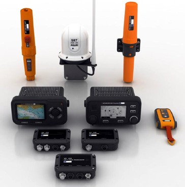
To broadcast a Class B AIS signal and use AIS information on your boat, you will need, at a minimum:
- Class B transceiver.
- GPS antenna
- VHF Antenna
- Either a dedicated display, or a networked connection to a display capable of using the incoming data.
Many AIS transceiver kits have built-in GPS antennas or come with a dedicated antenna. They may also have optional VHF antenna splitters to share your main VHF antenna instead of requiring a second one.
For receive-only AIS, you need a receiver connected to an antenna, and a way to see the information. They’re less expensive and easier to install, but they don’t help anyone to see you. There are several VHF radios on the market which receive AIS information you can use on your plotters with no additional hardware.

How is it different from Radar?
Radar and AIS have overlapping functions which complement each other nicely. But are quite different in how they locate and track contacts, and the nature of the tracked targets is different.
AIS requires other vessels to have a transceiver on board. If they do not have one, you will not see them with AIS. So it’s only good if others have it. But when AIS information is available from other boats, you should always get it and it’s very reliable and accurate.
Radar relies on reflections of a transmitted radio waves to find solid objects. It doesn’t matter what the other boats have installed, your radar can find them. Usually. Smaller boats made from wood and fiberglass are still hard for radar to pick up, especially if they don’t have a lot of freeboard like sailboats.
MARPA vs. AIS
Newer radar/chart plotter combinations have MARPA (Mini-Automatic Radar Plotting Aid) or similar capabilities. This software tracks persistent radar targets, and will show similar data for tracked contacts as AIS, with heading, speed, CPA and TCPA.
You can get the same information from an AIS transponder, but there are differences in accuracy. And that’s where Radar and AIS working together are such powerful overlapping tools.
The AIS data you get will be precise and updated every thirty seconds, but it won’t cover every vessel. Radar with MARPA can track boats without AIS, giving you an extra layer of coverage to see all the boats in the area, but you won’t have boat names and details, or an MMSI, and the data will be less precise.
AIS Extensions
AIS has gone way past simple collision avoidance. Satellites can read some AIS data, shore stations collect and repeat signals, all this data is being echoed to the internet, and AIS transmission has even reached crew overboard rescue tools.
Satellite AIS
Low-flying satellites can detect some AIS signals, increasing the range of AIS tracking from local VHF line-of-sight range to global ship tracking. This has led to advanced capabilities in Class A system for relaying position data, and better tracking of valuable cargo in transit.
Ships at sea with satellite communication can report the data they receive on the internet, expanding the reach of AIS tracking. If you sail near a large vessel with the right equipment on board hundreds of miles from shore, your small Class B signal may get repeated to the world.
So if you use a ship traffic website like Marine Traffic, the data reaches far beyond the range of coastal stations, and you can see some ships very far from shore with only a small time delay.
Internet AIS
Another powerful AIS extension is the availability of an internet stream of AIS data. Tools like AIS Live, available through iNavX, can put close to real-time AIS data on your screen with no AIS hardware on board. Some chart plotters and navigation software can treat it just like a live AIS feed from a receiver. All you need is an internet connection, so it’s great for near shore applications.
AIS Rescue tools
One of our favorite safety tools is an AIS-based crew overboard beacon. Installed inside an inflatable PFD, it triggers automatically when the PFD inflates and immediately sends a DSC emergency signal and broadcasts AIS position data for the overboard crew. Every vessel in range will get a loud alarm on their radio, a flashing target signal on their AIS-capable chart plotter, and instant updates on the crew position.
Compared to a Personal Locator Beach, an AIS beacon provides a local, automatic, and up to the minute trace on the lost crew. A PLB sends a signal via satellite to search and rescue services, but it doesn’t go directly to local ships on in the area. By law, one cannot rig a PLB to activate automatically.
Who really needs AIS?
If you spend time on the water and have a radio on your boat, you can benefit from AIS. At a minimum, you’ll see vessels around you with good data on collision risks. A small open recreational fishing boat may be fine with only a receiver.
But if you are planning longer trips away from shore, where you’ll come close to shipping and large commercial vessels, AIS is too powerful of a tool not to have on board. When we started cruising, we had a receiver only. But as soon as I upgraded to a transceiver, I realized just how much safety I’d been passing up.
Seeing and being seen isn’t just about dressing well for parties at the yacht club. Being seen on your boat can be a lifesaver.
- Posted in Blog, Boat Care, Boating Tips, Cruising, Fishing, iNavX, iNavX: How To, Interviews, Navigation, News, Reviews, Sailing, Sailing Tips
- No Comments
- Tags: AIS, transceiver, transponder


Leave a Reply