What To Know About Red, Right, Returning and Navigation Basics
August 2nd, 2024 by team
by B.J. Porter (Contributing Editor)
Most beginning boaters have heard the “Red, Right, Returning” rule, which tells you how to pass certain markers to avoid the dangers they’re keeping you off of. It’s a handy rule, and easy to remember, and will serve you well sailing in the U.S., Canada, the Caribbean and any other countries.
But that rule only works in some of the world. Specifically, it applies to countries in the IALA-B regions, which are North and South America, Japan, South Korea, and the Philippines. Everywhere else in the world, that rule will get you in trouble. And it is important to understand how the rule works, and why it works.
What is IALA?
For centuries, each country handled their own aids to navigation, resulting in a lack of a truly consistent system between countries. No one attempted to standardize until the early twentieth century, and in 1957, the International Association of Marine Aids to Navigation and Lighthouse Authorities, or IALA, formed.
Because of the historical differences in navigation systems worldwide, they IALA split the globe into two regions: IALA-A and IALA-B. Many of the same rules apply in both areas, but there is one key difference – the usage of red and greens in buoy marking is reversed. So Red, Right, Returning does not work in IALA-A regions!
Our primary audience is in North America, so we’ll address IALA-B by default. But if you are in the IALA-A region, make sure you reverse the red and green and check for other differences.
Lateral Marks
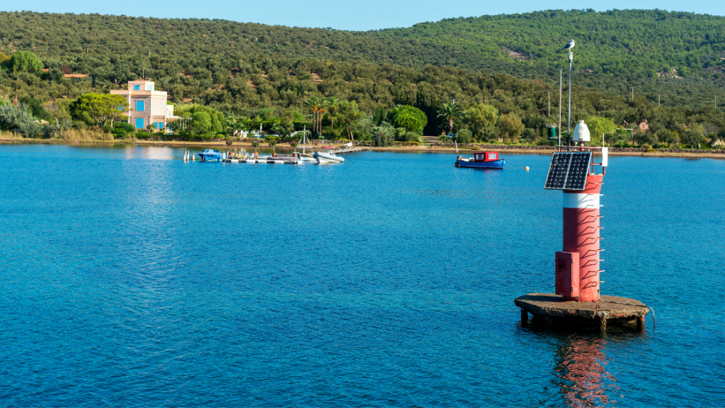
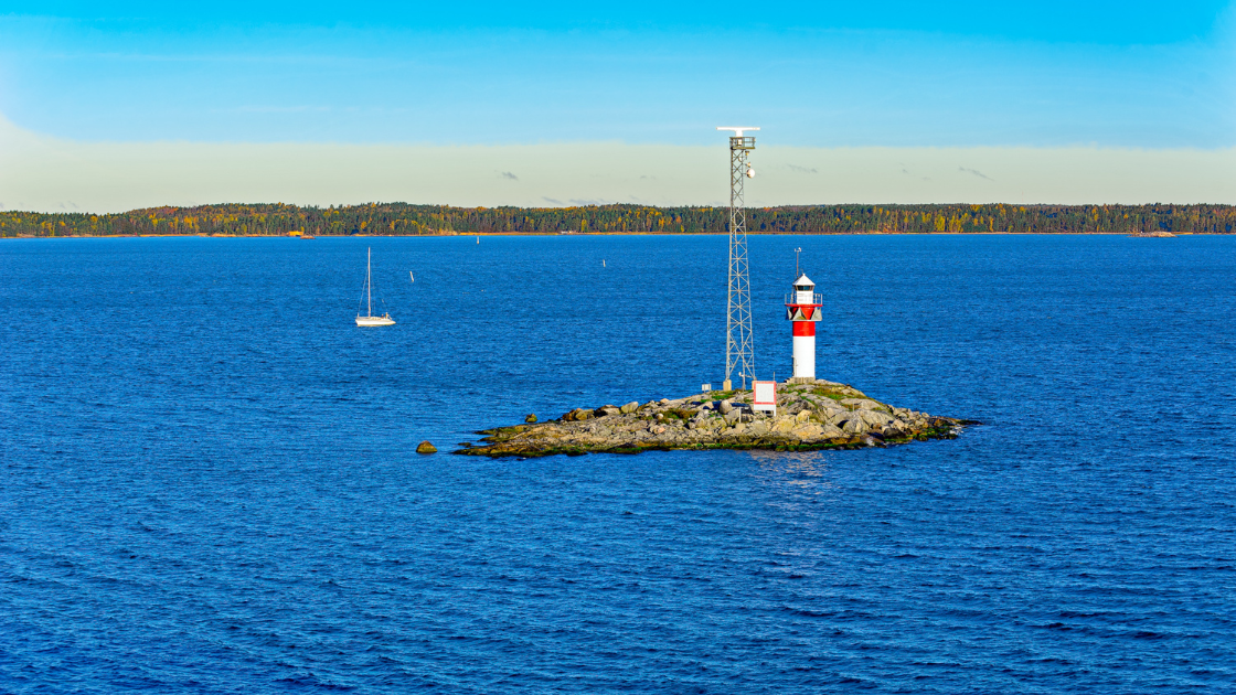
Lateral aids to navigation are fixed marks in or near the water to mark well-defined channels, preferred channels, safe waters, and dangerous areas. The most common are colored red and green, and some have distinctive shapes to help identification for low visibility conditions and the color-blind. They may also have lights, either constant or in fixed flashing patterns, and make sound signals.
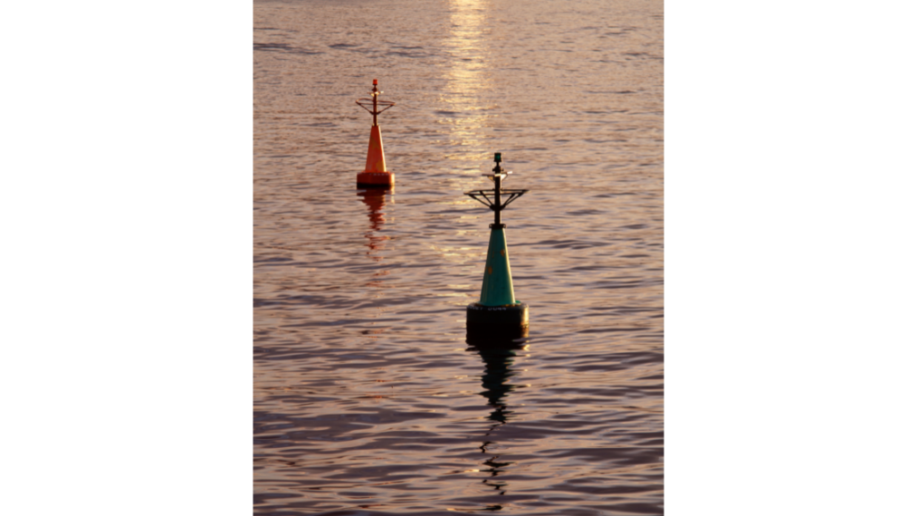
Not all lateral marks are buoys. They can also be “daymarks” – fixed posts in the water or on land. Smaller port-hand marks are cylindrical “cans” with flat tops, and starboard marks are conical “nuns” with a pointed top. Port day marks are square, starboard day marks are triangular. The colors will correspond to the IALA region – red nuns and triangles in IALA-B waters.
Lateral marks are numbered sequentially, starting at the entrance of a body of water with “1” on the first port marker, and even numbers on starboard marks. However, numbers may restart on smaller sub-parts of a large bay or complicated waterway.
So a complex body of water with multiple bays and tributaries may have multiple marks with the same color and number, but they won’t often be near each other. For example, Narragansett Bay has a green “1” mark at the entrance of the bay. But there’s a green “1” at the opening of Newport Harbor, Dutch Harbor, at the start of the East Passage towards Prudence Island, and at Round Rock at the entrance of Greenwich Bay, just to name a few. There are lots of G1 marks all over the bay, but they’re all a few miles apart, so you shouldn’t mix them up.
What does “Returning” mean?
On salt water, “returning” refers to “coming back from open water.” Literally, returning is the direction coming from the ocean into port. And for most waters, that’s pretty clear. If you’re heading home, keep the red marks to your right. When heading out, keep the green marks to the right.
It’s also heading “upstream” to the source or the head of the waters, though not every body of water has a source, so open water is a good reference. But on most bays and protected waters, the direction is pretty clear. Note also that when you are returning, the numbers on the buoys and daymarks will be increasing.
But there are a few instances where this convention isn’t so obvious. This is common in canals or transits between bodies of water. For example, the Cape Cod Canal runs between Buzzards Bay north to Cape Cod Bay. So which way is “back to sea?”
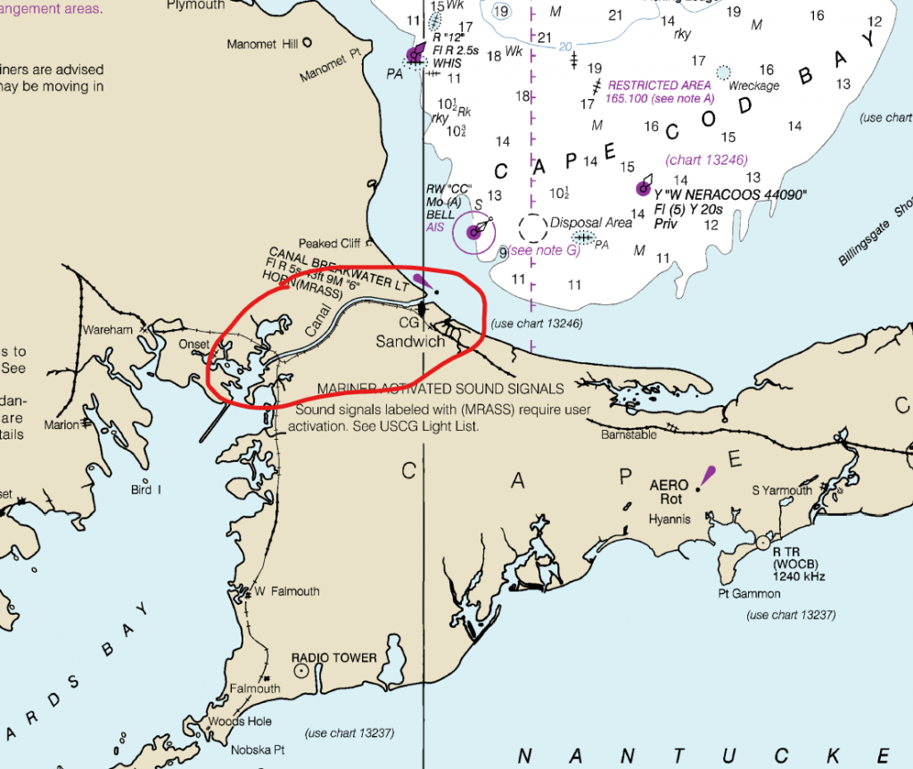
The Cape Cod Canal is a bit of a trick question. The flow in the canal reverses with the tides, so there is no clear “upstream.” And either end of the canal opens onto a larger body of water, so entering the canal is “returning” in either direction, right?
Well, the USCG decided that indeed was the case, since the opening of each end of the canal is buoyed as if you were returning into it from the ocean. That’s right, the channel markers on the Buzzard’s Bay side have red on the south side of the canal, or right as you enter the canal. And on the Cape Cod Bay side, the red markers are on the north side, which will be on your right as you enter but to your left as you exit. And there are no more markers inside the channel. The navigation rule is “keep to the right of the channel” and you’ll be fine.
What’s the takeaway? If you’re heading through a canal, pass, channel, thoroughfare, hole, or other passage between islands, bays or bodies of water, take an extra careful look at the charts ahead of time to make sure you understand the buoys.
Rivers
Rivers typically follow the “upstream” rule, with upstream as the returning direction. There are exceptions, specifically on the Mississippi River and its many tributaries in the middle of the country.
Western Rivers
The Mississippi River and all of its tributaries follow the Western Rivers Marking System, a variation on the standard marking scheme. There are no numbers, but there should be mile markers on most buoys. There may be day beacons and channel markers showing preferred channels, but many marks shift because of water levels, shifting shoals, and variable currents.
Intracoastal Waterway
Running from New Jersey to Texas, the ICW on the U.S. East Coast has a special marking system on top of the standard IALA-B markers. Reflective yellow triangles (starboard), squares (port), and bands (ICW identifier) mark the ICW through these waters.
When following the ICW, follow the shape of the ICW mark, not the color or shape of the lateral mark it is attached to. It can be tricky, and if you’re planning a trip on the ICW pay close attention to these sometimes subtle marks.
Lakes
Expect standard buoyage on the Great Lakes and some larger lakes created by the US Army Corps of Engineering. Smaller lakes may only have local buoys marking them, depending on lake ownership and management. They will often comply with or be close to IALA standards, but may lack consistent numbering or shapes. Consult with local authorities, harbor masters or a marina near where you plan to launch your boat.
What about marks with BOTH colors?
That’s a good question, and it’s not uncommon to see a mark with red and green bands on it. These marks are often found near islands or areas where there are multiple channels and forks around shallows and hazards. These are preferred channel markers, and they tell you the best way around the hazard.
For a boat approaching a preferred channel marker, treat the marker as is if it is the color of the top band. This will put you on the preferred route around the hazard.
While you usually can go the other way safely, there’s a reason for the preferred channel. It may have greater depth, better current, a wider passage, or it’s for traffic management and collision prevention. It’s better to be headed in the same direction with large commercial vessels than against them, for example.
And all those other marks?
There are many other marks you may encounter on the water. We’ve only covered the basic red and green ones in this article. In a future installment we’ll get into more about safe water marks, hazards, special buoys, range marks, and other aids you may encounter.
So now…study your charts and make sure you know what marks to look for on your next trip! We’ll get to them all, but if you can’t wait, the USCG publishes an excellent summary for free. And if you want all the dry details for everywhere in the world with examples, the official IALA buoyage system is available here.

August 07, 2024 at 6:51 pm, Steve Lamothe said:
Great explanation of the Channel markers did not no the difference between the two regions
August 14, 2024 at 4:34 am, B.J. Porter said:
You’re unlikely to run across it unless you charter outside the Caribbean or head out to cruise on your own boat. So it’s not well known unless you look more closely at it.
It definitely took some getting used to the first time we ran into it. But you adapt pretty quickly when it’s all you see.
Definitely easier to deal with switched buoys than rotaries when everyone is on the wrong side of the road!
August 08, 2024 at 6:30 pm, Roberta Darrow said:
What about Wrangell Narrows in SE Alaska?
August 14, 2024 at 4:29 am, B.J. Porter said:
Looking at a chart, if I have the right place (between Mitkof and Kupreanof Islands), it seems fairly straightforward, with red marks on the east side of the narrows…right up until you zoom out on the chart!
That’s a tricky spot to figure out, and definitely would be a surprise if you didn’t check a chart first because it sure looks like you’re headed away from open water in that direction!
August 09, 2024 at 5:05 pm, Len Westra said:
Good article. Here in Casco Bay Maine it’s often confusing which harbor you’re returning to and easy to make the wrong assumption on which side to take a buoy
August 14, 2024 at 4:24 am, B.J. Porter said:
I was thinking a lot of Maine and places like Deer Island Thorofare and a few others up there which aren’t entirely clear which way is back from sea and out to sea!
August 10, 2024 at 3:03 pm, Bill Crosby said:
This is a very good refresher on why paper charts need to be at hand while entering or traversing unfamiliar waters. On New Hampshire lakes there is a very different system. It works but requires a new mindset. Thanks.
August 14, 2024 at 4:35 am, B.J. Porter said:
How does it work on the NH lakes? Are those maintained by the state?