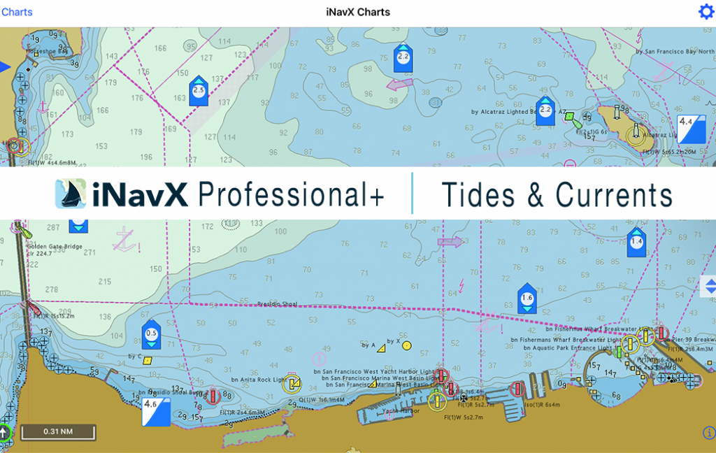
iNavX Tides & Currents delivers real-time tide heights, current speeds, and critical tidal events, like high and low tides, slack water, sunrise, sunset, and moon phases, as an overlay on your charts.
Powered by thousands of official NOAA tide and current stations across the U.S., this feature gives you precise, location-based forecasts integrated directly into your map view. Tap any station to see upcoming tide events, generate predictive graphs, or access multi-day forecasts.
iNavX Tides & Currents also supports advanced chart overlays, graphical tide predictions, and interactive station selection, so you can view trends, plan routes, and adjust timing with total confidence.
Data supplied by SiiTech Inc.
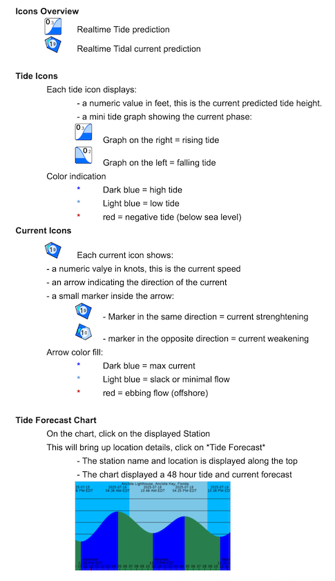
Tides & Currents – Legends