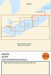
CHS: RM-CEN04 Lake Erie
Coverage includes but is not limited to:
- Covers Canadian side of Lake Erie from St. Catherines, the Welland Canal to Pelee Island and navigable harbours.
- Contains Raster Navigation Charts (RNC) in BSB v3.0 format of the following paper charts:
- 2042, 2100, 2110, 2120, 2121, 2122, 2123, 2140, 2165, and 2181.