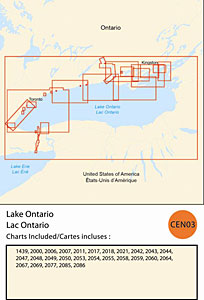
CHS: RM-CEN03 Lake Ontario
Coverage includes but is not limited to:
- Covers Canadian side of Lake Ontario from Kingston to Niagara River including Toronto, Hamilton and navigable harbours.
- Contains Raster Navigation Charts (RNC) in BSB v3.0 format of the following paper charts:
- 1439, 2000, 2006, 2007, 2011, 2017, 2018, 2021, 2042, 2043, 2044, 2047, 2048, 2049, 2050, 2053, 2054, 2055, 2058, 2059, 2060, 2064, 2067, 2069, 2077, 2085, and 2086.