iNavX now with Delius Klasing for Europe
May 8th, 2019 by team
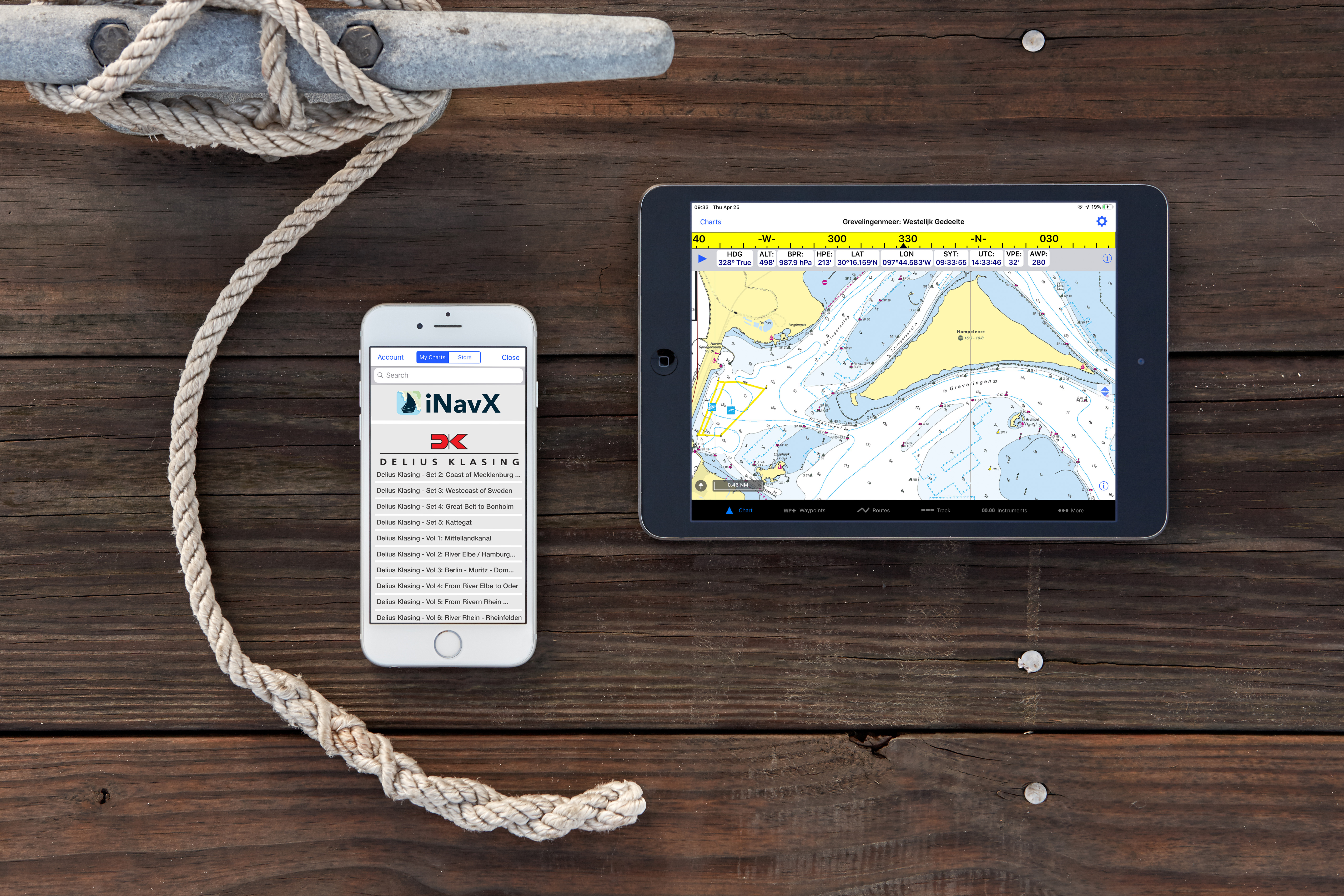
| Delius Klasing European chartsNow available in the iNavX app |
iNavX the leading marine navigation app now provides access to Delius Klasing’s detailed digital charts for European inland waterways and sea charts. iNavX is the only marine navigation app to offer a full suite of worldwide charts from multiple chart providers that include NOAA raster charts, Navionics vector charts, Blue Latitude, Explorer Bahamas, Waterway Guides, CHS charts, and now better coverage than ever with the inclusion of Delius Klasing.
iNavX transforms popular phones and tablets into full functioning, handheld chartplotters. Sophisticated navigation functions can be used anywhere in an easy to use app. Location, Heading, Speed, COG, Waypoints, Routes and other navigation functions are attractively displayed on the device. Advanced features include high-resolution weather overlays and AIS data that are easily activated within the app. Access to worldwide charts from leading chart providers in iNavX and its full suite of MFD features lets boaters navigate safely and effectively on any boat anywhere in the world. Planning trips and setting routes can be done remotely, alleviating the need for boaters to access their vessel and enter coordinates into sometimes cumbersome onboard plotters. Multiple devices can be accessed allowing the user to pull up their iNavX navigation functions and full suite of charts on their smart phones as well as tablets. iNavX is fully compatible with both iOS and Android devices and is available as a simple download from the Apple App Store or Google Play Store.
“We feel honored and privileged to work with the amazing Delius Klasing team to add their fantastic European charts to iNavX. This partnership further demonstrates why we are the leading marine navigation app. No other handheld marine chartplotter has the versatility and global capabilities of iNavX,”
Explains Shaun Steingold, General Manager of iNavX.
About iNavX
iNavX leads the marine marketplace by delivering a fully functional MFD/Chartplotter in an easy to use App format. With more charts and chart providers to choose from than any other app or built-in plotter, a suite of features including weather and AIS, iNavX is the most modern and efficient marine navigation tool available.
www.iNavX.com

About Delius Klasing Verlag GmbH
Based in Bielefeld, Germany, Delius Klasing founded in 1911 is one of Europe’s leading special interest publishers. The fourth generation managed family business publishes books, calendars, special interest magazines and electronic media in segments that include water sports, cycling, sports and automobiles. Their marine portfolio includes the magazines Boot, Yachts and Surf. They also produce a well known series of digital charts for Europe.
www.delius-klasing.de
Comments are closed.
